


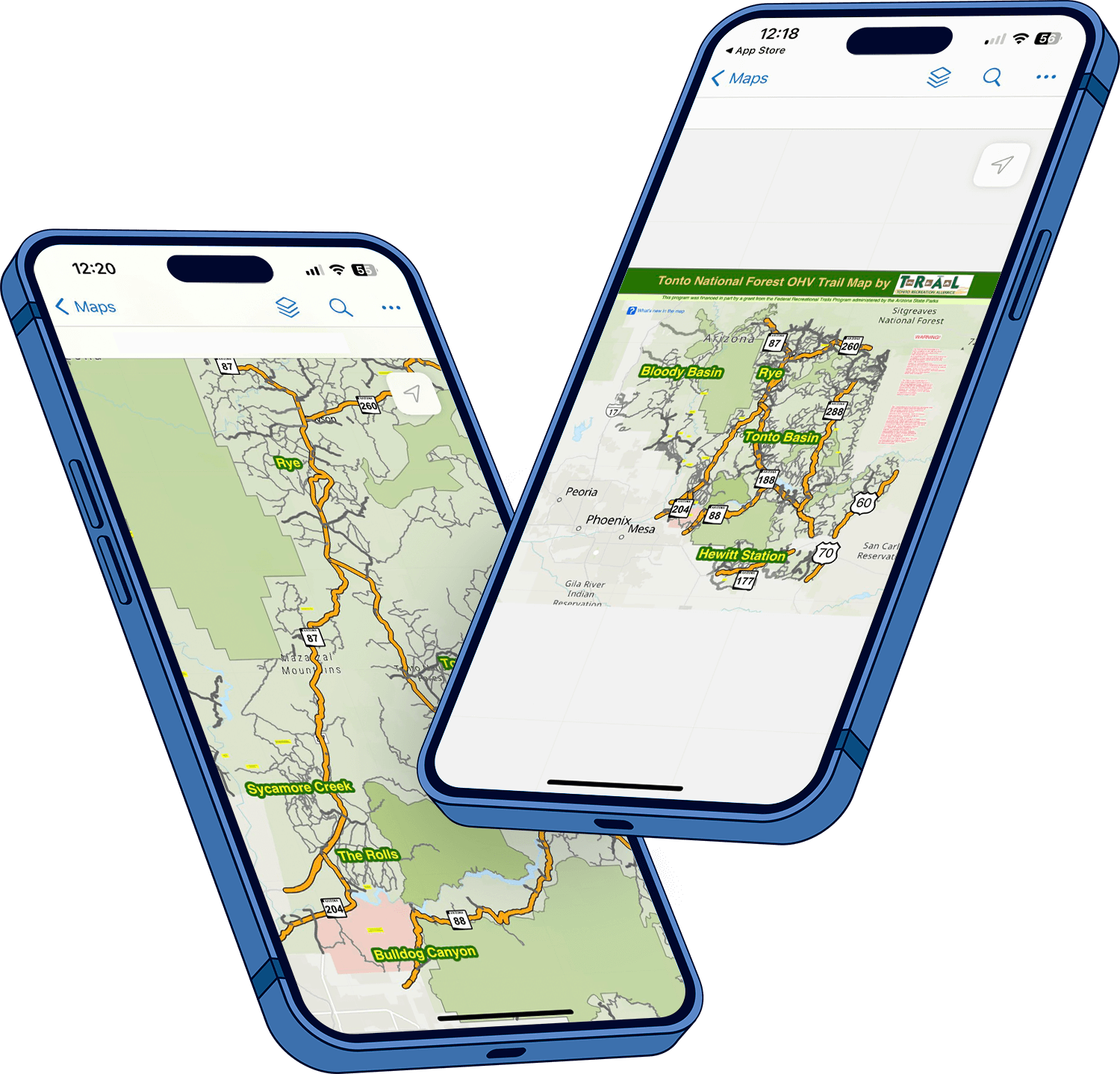
The map is available as a download for Apple and Android phones and tablets. It works offline and does not require cell service or Wi-Fi once downloaded.
STEP 1: Get the free Field Maps app from your device’s app store.

STEP 2: When you open the Field Maps app, if it asks for a login, touch “Skip sign in”.
STEP 3: Using the search function (magnifying glass) in Field Maps, search for Tonto National Forest OHV Trail Map by TRAL then tap the download button once found.
Frequently Asked Questions
Field Maps OHV User Map Quick Start Instructions


The Field Maps app includes Markup Layers which you can see listed in the image above. These layers allows you to record your own points and notes. See this link for information about how Markup works.
Does the map work offline?
Yes. Once the map is downloaded to the phone or tablet, it does not require a cellular or Wi-Fi connection to work.
Are there software requirements for phones and tablets to run the Field Maps app?
Yes. Android devices require Android 8.0 (Oreo) or later. Apple devices require iOS 14.5 or later.
Can I use this map with my Garmin or other GPS unit?
No. This map is only available for use with the Field Maps app running on an Apple or Android phone or tablet.
Are all Tonto OHV routes shown on the map?
Trails shown on this map are based on GPS tracks collected by Tonto Recreation Alliance while traveling on routes currently designated as open by the Tonto National Forest. Some existing trails are NOT shown on this map while they are under review with the forest for data accuracy.
Why do some routes not have numbers?
Some routes were just added to the system recently and have not been assigned numbers yet. Route numbers will be added when they have been assigned. All routes shown on the map are currently designated as open.
Is there a paper version of this map?
No, not at this time. A paper version may be made available in the future but for now, the map will be undergoing regular updates and additions of information which are difficult to keep up with on a paper map.
Will additional features be added to the Field Maps app?
The Field Maps app is a product of ESRI and is used as is for the delivery of Tonto OHV map information. Any updates to the app are solely at the discretion of ESRI.
Will there be updates to the map information?
Yes! The Tonto OHV User Map project is about continual updates of information, ongoing accuracy improvement and additions of helpful, fun and interesting content. Check for map updates regularly.
Why does the map content have an expiration date?
The maps are set to expire on a regular basis to help make sure that all users have the latest version. A new version of the map will always be made available before the current map expires. An expired map will still work but will warn the user to update the map when convenient.
What are possible enhancements for the OHV Map?
- Points of interest
- Additional information about trails including surface conditions, scenery, etc.
- Topographical elevation contour lines
- Historical fire information
- Vegetation zones
- More known trail issues
- More Best of the Tonto trips
- Historical points of interest and general history